

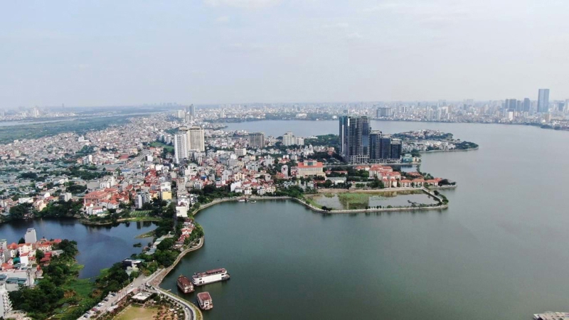
The People's Committee of Hanoi's Tay Ho Ward in collaboration with the Hanoi Institute of Urban Planning, has officially announced a detailed master plan for the central spatial axis of the Quang An Peninsula.
The plan, covering a total area of 44.1 ha, will focus on integrated land use, architectural and landscape design, and the development of essential technical infrastructure.
At its heart, the master plan aims to create a central green axis featuring public parks, entertainment zones, a park for spiritual culture, and a thematic park dedicated to arts and culture. This public space will be integrated with commercial, service, and hotel developments designed for tourism and leisure.
The new landscape will be structured around the peninsula's central axis, which will serve as the primary planning corridor to seamlessly blend cultural, artistic, and recreational functions.
Beyond the peninsula itself, the plan establishes a crucial spatial corridor connecting key areas: the West of West Lake new urban center, West Lake, the Quang An Peninsula, the Red River, and the historic Co Loa Citadel.
This corridor is designed to preserve, enhance, and leverage the unique cultural and scenic values of the region, including the natural beauty of West Lake and Dam Tri Lake, as well as existing historical and religious sites. A key goal is to ensure the new developments harmoniously integrate with the architecture and landscape of surrounding projects.
According to the Hanoi Institute of Urban Planning, this detailed 1/500 plan is a crucial step in implementing the broader Urban Zoning Plan for the West Lake and vicinity area and the Hanoi Capital Construction Master Plan to 2030, with a vision toward 2050.


